A Winter That Wasn’t: What Low Snowpack Means for Idaho’s Rivers
Across Idaho and the broader Mountain West, this winter has fallen short in a way that is becoming increasingly familiar. Snowpack levels, the natural water storage system our rivers depend on, are concerningly well below average across the state. We monitor the snowpack like a vital pulse, because we know that the health of our rivers, our fish, and our recreation communities depend heavily on that watery bank account. While winter storms did arrive intermittently, they were often warmer and less productive, leaving much of the landscape with a thinner and more fragile snowpack than we would hope to see heading into the boating season.
Snowpack is more than just a seasonal marker. It is the foundation of our water system. A strong snow year builds a slow-release reservoir that feeds rivers, recharges groundwater, and sustains cold, clean flows well into the summer months. This year, that foundation is dramatically weaker. While we will cross our fingers for some colder-than-average April storms, especially in the high country, it is certainly shaping up to be a low-water year in Idaho.
As we move into spring, early indicators suggest runoff will arrive sooner than normal. Warmer conditions and a reduced snowpack mean that what snow we do have will melt earlier and faster. Instead of a gradual, sustained release of water, we are likely to see an earlier peak in flows followed by a quicker drop-off. In practical terms, that means rivers may look healthy in the short term, but could decline rapidly as summer progresses. Be ready for some technical boating if you have an August Middle Fork permit…
Looking ahead, forecasters are also beginning to discuss the likelihood of an El Niño pattern emerging this summer and persisting through the end of 2026. While these climate patterns are never perfectly predictable, El Niño years tend to bring warmer conditions to the northern Rockies, often limiting snow accumulation and reinforcing the trends we are already seeing.
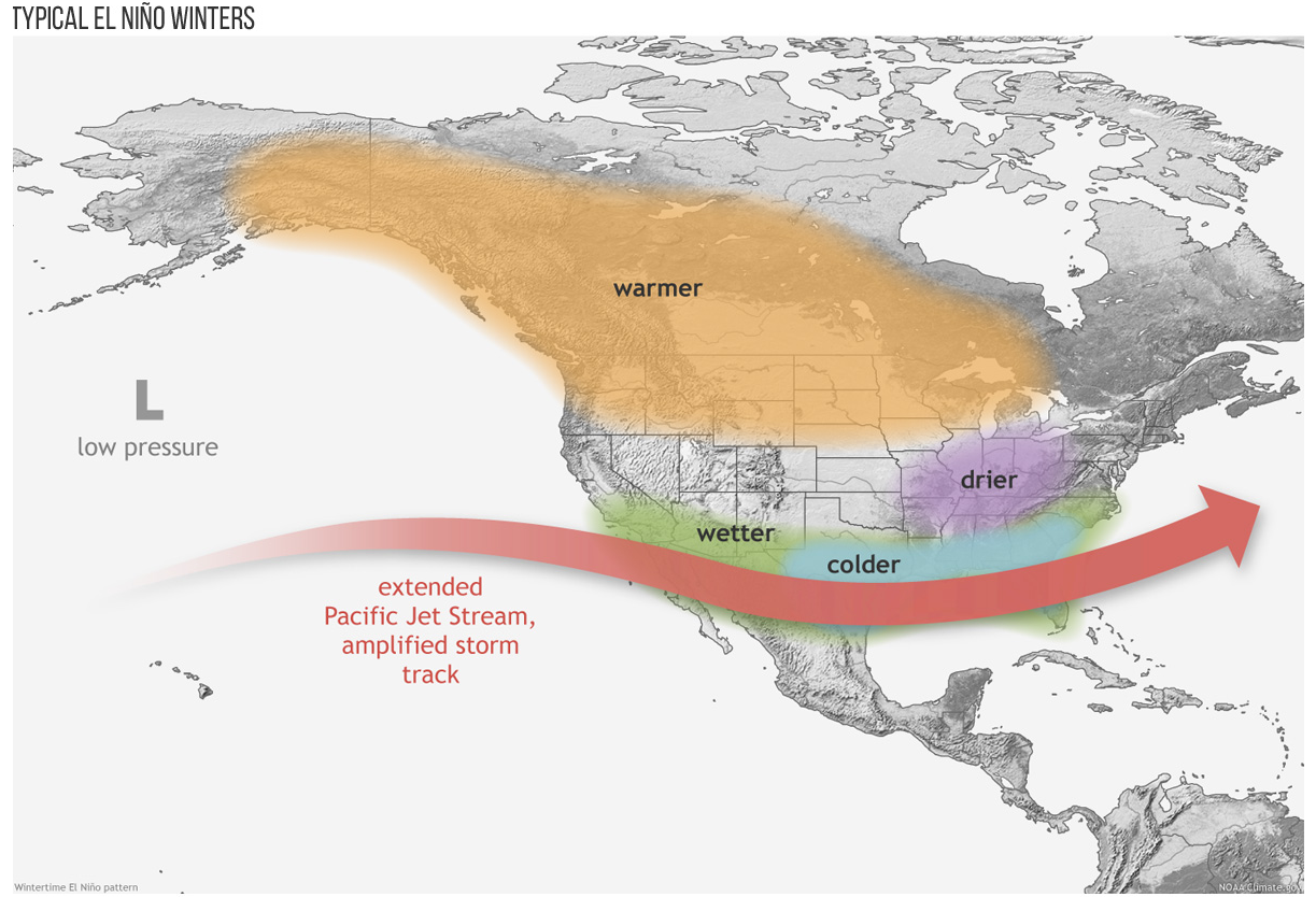
National Weather Service - Typical El Niño winter
Looking ahead to summer, several concerns come into focus.
Fire risk is one of them. Earlier snowmelt leads to earlier soil and vegetation drying, extending the fire season and creating conditions for larger, more intense fires. We have seen this pattern play out in recent years, and this season may follow a similar trajectory. This trend is unfortunately not limited to Idaho. When looking at the broader Mountain West, it is clear that we may be in for a long, smoky fire season.
Second, hand-in-hand with the weak snowpack and potential for lower flows comes increased water temperatures. Lower flows combined with warm air temperatures tend to push rivers past thresholds that are stressful for fish. For coldwater species like salmon and steelhead, this is particularly concerning, especially during migration and spawning periods when these fish are more vulnerable.
Finally, reservoir storage may come under pressure. Water managers will be balancing early inflows with the need to stretch supplies through the late summer. Without a strong snowpack to sustain inflows, maintaining adequate storage levels becomes more challenging, especially in systems already experiencing high demand.
Taken together, this year’s conditions are a clear reminder of how closely our water future is tied to winter. When snowpack declines, the impacts ripple through our rivers, our communities, and our ecosystems.
These conditions and trends underscore the importance of building resilience into our river systems, protecting and restoring the natural processes that help store water, keep rivers cool, and sustain flows when they are needed most. In the meantime, we’re going to hope for a wet spring and early summer as we look forward to days on our favorite rivers. After all, any day boating is a good one. Fingers crossed.